Known for it’s “Mighty Five’ national parks, Utah is no stranger to year-round crowds. Especially at the four more recognizable national parks Arches, Zion, Bryce Canyon and Canyonlands. With their breathtaking views and picturesque trails, these four parks are bucket list candidates for any outdoor enthusiast.
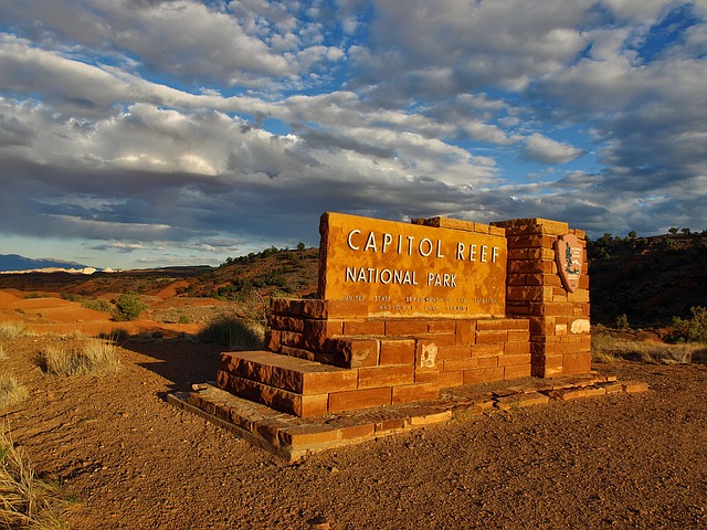
However, located in south-central Utah is one of it’s best kept secret, Capitol Reef National Park. Located in the heart of red-rock country, Capitol Reef offers 378 square-miles of cliffs, canyons, domes and plenty of geological wonder.
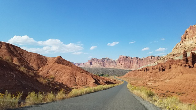
Starting with Waterpocket Fold, the park’s main attraction. Known as a 100-mile wrinkle on the earth’s surface, this geologic monocline is not only the most accessible portion of the park, but it also defines Capitol Reef National Park.
With white domes of Navajo Sandstone that resemble the capital building domes and difficult to traverse 87-mile long ridges similar to an ocean reef. Is how the park’s name Capital Reef came to be.
Like the rest of the “Mighty Five,” there’s plenty to do at Capitol Reef other than just admiring the rock formations. The area is rich in Native American history, visitors can see ancient habitation sites and petroglyphs, which are visible throughout the park.
Visitors to the park can also find thousands of fruit trees in the Fremont River Valley, that were planted by Later-Day Saints pioneers in the early 1880s.Today the orchards are part of the Fruita Rural Historic Landscape and are looked after and harvested by park staff. Visitors can also pick fruit from the trees marked by “U-pick fruit” signs or enjoy a freshly baked pie at the Gifford House.

10 Scenic Hikes Located in Capitol Reef National Park
Capitol Reef National Park has so much to offer, everything from short and easy hikes to longer adventures treks into more remote corners of the park, with that said we’ve narrowed down the top 10 most scenic hikes the park has to offer.
Sunset Point Trail
Located just off of Utah Highway 24, three miles west of the park’s visitors center, is a turnoff for Panorama Point. Follow the dirt road past Panorama Point to the Goosenecks Overlook, and there you’ll find the often-overlooked Sunset Point Trail. At just 0.8 miles roundtrip, this is the shortest hike in the park.
The Sunset Point Trail follows the rim of Sulphur Creek Canyon to a fantastic viewpoint of the cliffs and domes in the park and is especially dramatic at sunset. Just make sure you start hiking an hour before sunset and we’ll guarantee you’ll be ending the day on a high note.
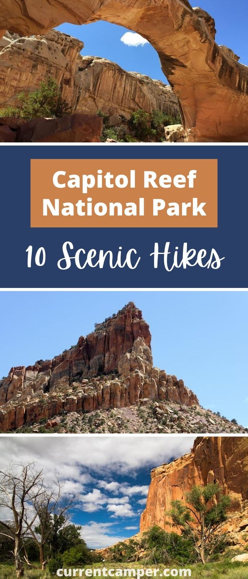
Hickman Bridge Trail
The Hickman Bridge is one of the most famous formations in Capitol Reef National Park. This huge natural arch, which sits high above the Fremont River, is 133 feet wide and 125 feet high.
The hike to the arch is only one mile from the trailhead and on the way there you’ll pass several ruins left behind by the Fremont people, including an ancient pit house and granary.
Capitol Gorge Trail
In one mile of mostly level walking, Capitol Gorge Trail hikers will get to experience several of the park’s most notable sights, including a petroglyph panel and the Pioneer Register, a collection of historic inscriptions on a rock wall.
They will also pass the park’s famous water tanks, which are a collection of waterpockets or potholes that store water and allow a vast array of animals and plants to exist in the arid desert.
The hike which begins at the end of the unpaved Capitol Gorge Road, is also a great trial option for families with small children.
Read More: Best Short Hikes in Yellowstone
Cassidy Arch Trail
If you only have time for one hike while visiting Capitol Reef, then we highly recommend the hike to Cassidy Arch. Named after Butch Cassidy, the famous outlaw who once used the area as a hideout, the trail starts at the Grand Wash Trailhead and is only 1.75 miles long.
Once you reach the spectacular natural stone arch you’ll be able to take amazing pictures from any angle. You’ll even be able to stand on top of the photogenic arch. Just follow the well-marked trail that is part of the Frying Pan Trail and make sure to be careful with children, as it does have plenty of steep drop-offs.
This semi-strenuous trail to Cassidy Arch, starts at the floor of Grand Wash and features some steep climbs to the cliffs, which overlook some of the most amazing landforms in the park.
Golden Throne Trail
The Golden Throne Trail is one of Capitol Reef’s lesser-used trails and a great alternative to the more traveled Capitol Gorge Trail. Both trails begin from the same parking area.
Rather than following the canyon bottom, the Golden Throne Trail ascends from the bottom of the canyon to the cliffs at the base of the Golden Throne, a massive Navajo sandstone formation that glows a golden yellow at sunset.
DAY HIKE: What To Bring On Your Next Adventure
The trial is a two mile hike with a 700 foot climb to get to the viewpoint, but don’t worry there are plenty of spots to stop and catch your breath along the way. Once you reach the top you’ll be wowed but the amazing scenic viewpoints. Especially, at sunset.
Sulphur Creek
The hike through Sulphur Creek is a 5.8 mile one-way hike through a colorful canyon with waterfalls, swimming holes and other obstacles. The hike which starts at the Chimney Rock Trailhead, requires leaving a shuttle vehicle at each end of the trail.
For those that don’t have two vehicles, a 3.3 mile hike along Highway 24 is required to loop back to the starting point. Just keep in mind that vehicle shuttles are not provided by the park.
The hike is best done during warmer weather since you’ll be getting wet while hiking through the creek. Hikers also have to scramble to get around the three waterfalls, so if you’re hiking with children they’ll definitely require some assistance to bypass the falls.
Also, flash floods are a real risk in this narrow canyon, so make sure to inquire about the current water levels at the visitors center before attempting the hike and do not hike the route if there is any chance of rain.
Surprise Canyon
Surprise Canyon is a short section of narrows cut into the Waterpocket Fold and is one of the most accessible narrows in the park. This two mile round-trip route crosses grassy drainage, before entering a deep canyon.
The hike is often combined with a quick jaunt into nearby Headquarters Canyon, both are great family-friendly hiking trail options in the southern section of the park.
However, the trail is not that easy to get to. Starting at the visitors center, hikers first have to drive for about two hours on mostly unpaved roads to reach the Surprise Canyon trailhead. Once you reach the trailhead and start your hike you definitely won’t regret it.
Those any that make the trip out to the remote southern Waterpocket region of the park, will be rewarded with incredible hiking opportunities and very few people.
Read More: 10 Benefits of State Park Camping
Upper Muley Twist
Upper Muley Twist will give you the “biggest bang for your buck” when it comes to trail scenery in the park. The route traverses the spine of the Waterpocket Fold passing by numerous arches and through a short narrows section with sweeping views in any direction you look.
A 4×4 vehicle is required to get to the trailhead and although the trail is well marked with rock cairns and signs, some route-finding skills are helpful. The loop is about 9.5 miles, but you’ll need to add on an additional five miles if you don’t have a 4×4 vehicle.
Halls Creek Narrows
Halls Creek Narrows is by far the most dramatic canyon in the park. It’s a deep and narrow gulch carved into the sloping sandstone of the Waterpocked Fold surrounded by sheer cliffs sometimes rising more than 650 feet overhead.
The canyon is filled with water most of the year so some wading and swimming is required through the narrowest sections. The route is typically done as an overnight backpacking trip, but strong hikers can do it in one day.
Cathedrals Trail
Even though there are no official trails in the Cathedral Valley District of the park, there are a handful of old roads and unmaintained trails. The Cathedrals Trail is an easy 2.4 mile round-trip route that begins from the floor of the Upper Cathedral Valley and gets hikers up close to the giant sandstone monoliths that gives the region its name.
The Cathedral Valley is even more remote than the southern Waterpocked District and a high clearance vehicle is necessary to reach this rugged region of the park. Reaching Cathedral Valley does require fording the Fremont River, so it should not be attempted during high water periods, since there is no bridge.
Have you ever been to Capitol Reef National Park?
Pin it!